OutdoorsAugust 9, 2013
Too Crooked River
Fish-friendly project would undo unnaturally sharp turns of the tortuous meanders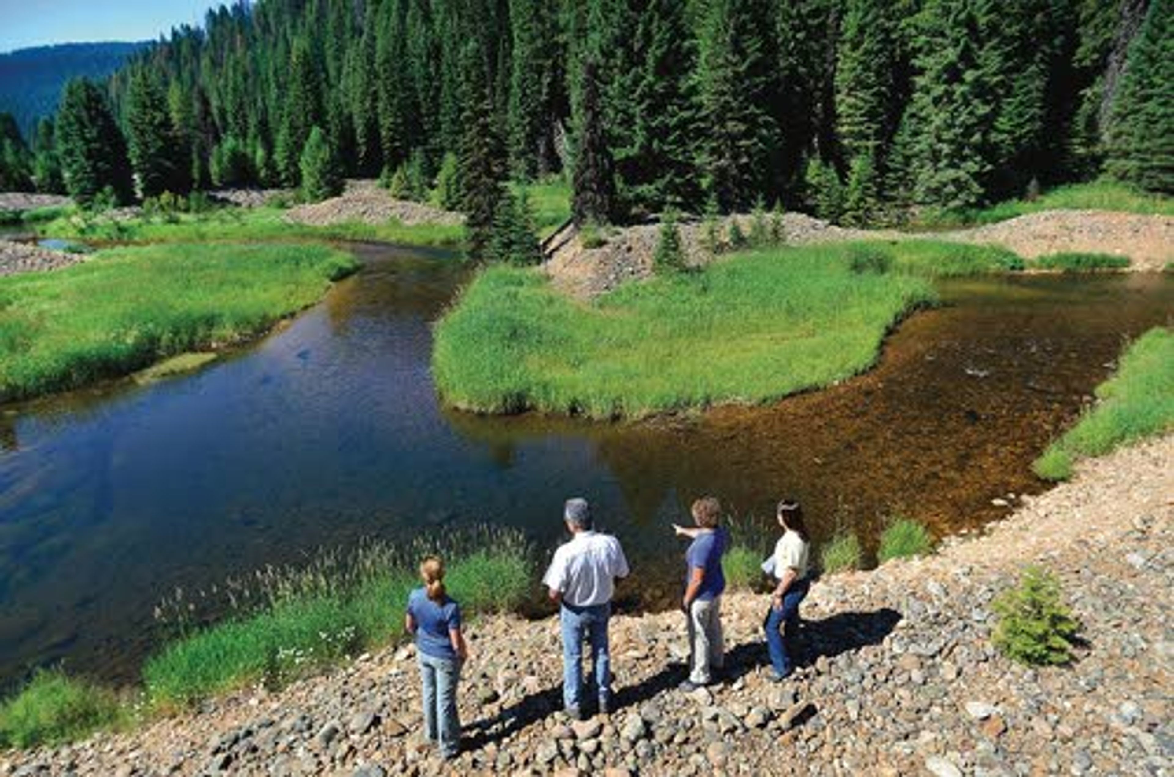


ELK CITY - In most river and floodplain restoration projects, meanders are restored to stream beds that have been straightened over the decades.
But the opposite could happen in a 2-mile section of the Crooked River just above its confluence with the South Fork of the Clearwater River.
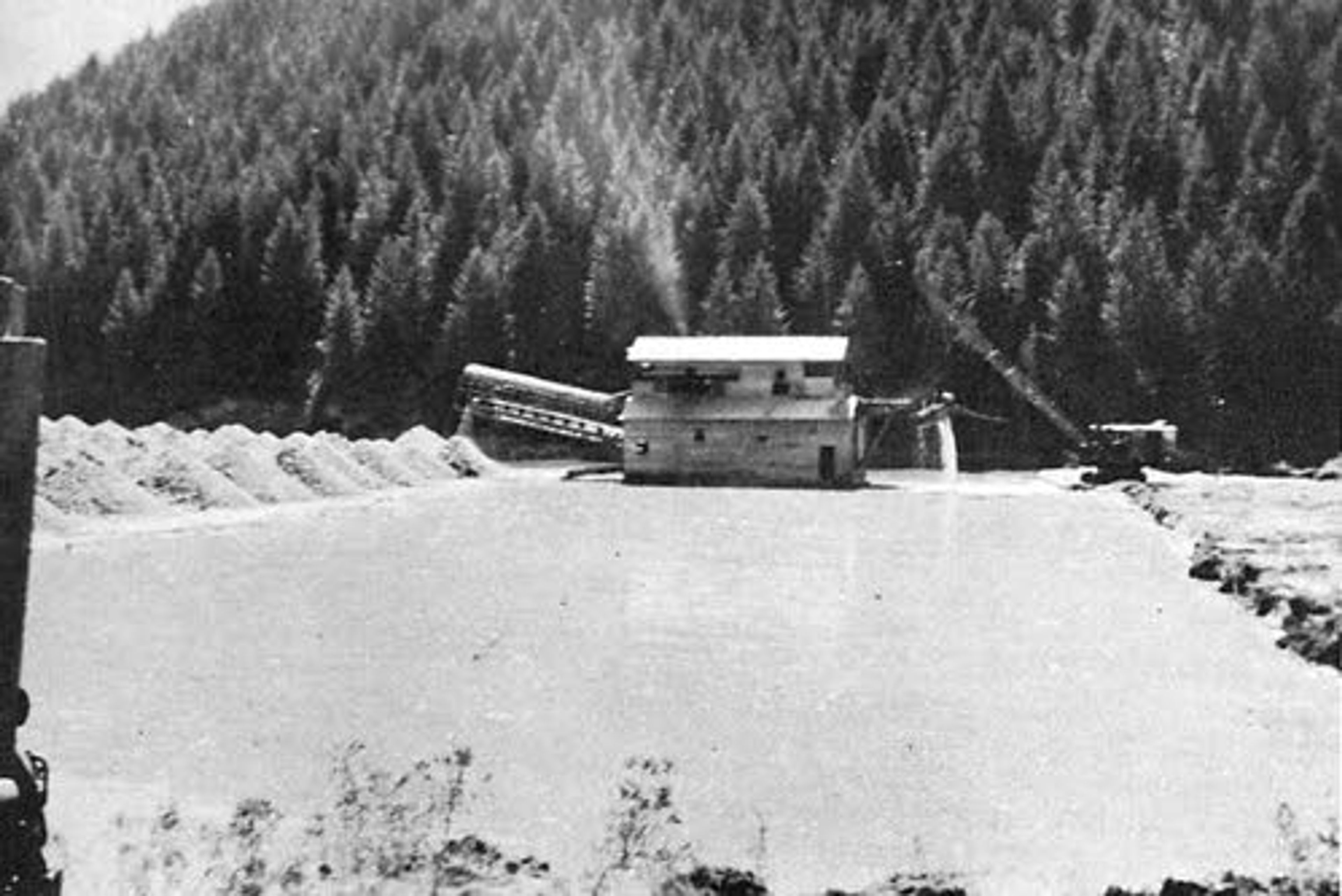
Mining there literally turned the valley bottom upside down. From the 1930s to the 1950s, industrial dredges churned their way upstream and left behind a maze of tailing piles that have confined the river to an unnatural zigzagging course known as the torturous meanders.
"The Crooked River itself has a very high potential for fish production, but the lower two miles have been highly degraded by mining," said Emmit Taylor Jr., acting director of the Nez Perce Tribe Watershed Division.
Because of the zipper-like tailing piles, the river is unable to naturally carve its way back and forth across the valley. Fine organic material, sand and sediment isn't deposited in the floodplain, where it would normally feed a rich riparian zone. The river doesn't spread out during high water and isn't allowed to move and sort rocks and gravel to create spawning habitat. In the summer, the lack of streamside vegetation causes the water to get too warm.
"Right now it's not high-quality habitat for fish," said Heidi McRoberts, deputy director of the tribe's watershed division.
The tribe and Nez Perce-Clearwater National Forest hope to fix the problem in a large-scale restoration project that would improve habitat for wild B-run steelhead and bull trout, both of which are protected by the Endangered Species Act. It would also help unprotected but sensitive spring chinook salmon and west slope cutthroat trout.
According to initial plans, the tailing piles would be leveled and the tortuous section of the stream channel would be reconstructed. Riparian zones would be restored and planted with trees and shrubs to provide shade.
"Basically, it's shortening the river up and making a better gradient and better habitat for the fish there," said Jennie Fischer of the Nez Perce-Clearwater National Forest.
Right now the river follows in a series of sharp "S" turns for a distance of 3.1 miles as it flows through a 2-mile-long section of valley. When the work is done, the river will cover 2.6 miles.
"This is one of the few projects where we are de-meandering," said Jenifer Harris, project leader for the tribe.
Upstream of the tortuous meanders, Crooked River Road will be raised and moved against the hillside. Doing so will protect the road from flooding and the river from road-borne sediment.
The work would occur over several years and be funded largely by the Bonneville Power Administration. Because the agency is trying to mitigate for steelhead killed at lower Snake River and Columbia River dams, it is willing to pay to improve important fish habitat in tributaries to the rivers. According to a biological opinion governing operations at the dams, survival of B-run steelhead in the South Fork Clearwater River needs to improve by 14 percent to offset dam mortality.
"There is an opportunity to fix things where there wouldn't have been prior," David Johnson, director of the tribe's fisheries division, said of the BPA funding. "This project is a huge challenge. Back in the day there just wasn't any way to take on this big of a project."
Daily headlines, straight to your inboxRead it online first and stay up-to-date, delivered daily at 7 AM
Nez Perce-Clearwater National Forest Supervisor Rick Brazell calls it a white-hat project.
"To me it would improve the road and improve the fishery. It's a good thing," he said.
But that depends on who you ask. Idaho County is dead set against it. County commissioners say it will destroy local mining history, the environment and the fishing. They believe it's wasteful and will negatively effect local culture.
"We just thought it's a massive waste of taxpayer money," said Idaho County Commissioner James Rockwell. "We thought it was very sad we would go in and destroy this mining culture, this mining history, destroy the environment for no reason."
It's true the tailing piles, a legacy of both the mining history of the area and its destructive effect on the environment, would be removed. But they would not disappear completely. Because they are more than 50 years old, the tailing piles are considered historic features. Forest officials are working with the state of Idaho Historic Preservation Office to mitigate some of the destruction.
Steve Lucas, an archeologist on the Nez Perce-Clearwater, said the plan calls for the dredge piles to be recorded before they are re-contoured and for the site of a nearby Great Depression-era mining village to be documented. A few of the tailing piles will be preserved and the agency will add signs explaining the mining history to visitors.
"That is the trade-off. We are going to take way from what is there but enhance what remains," Lucas said.
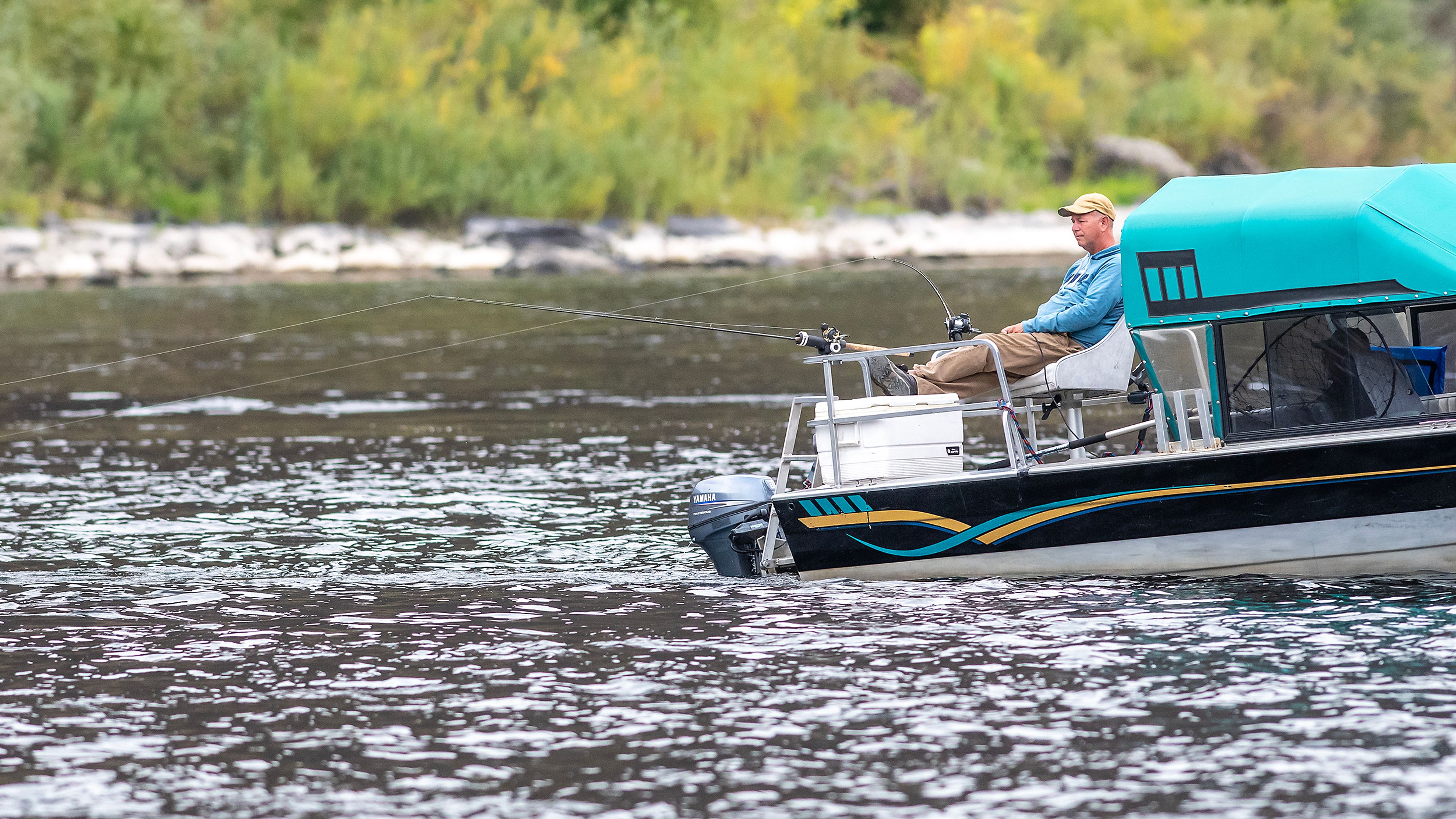
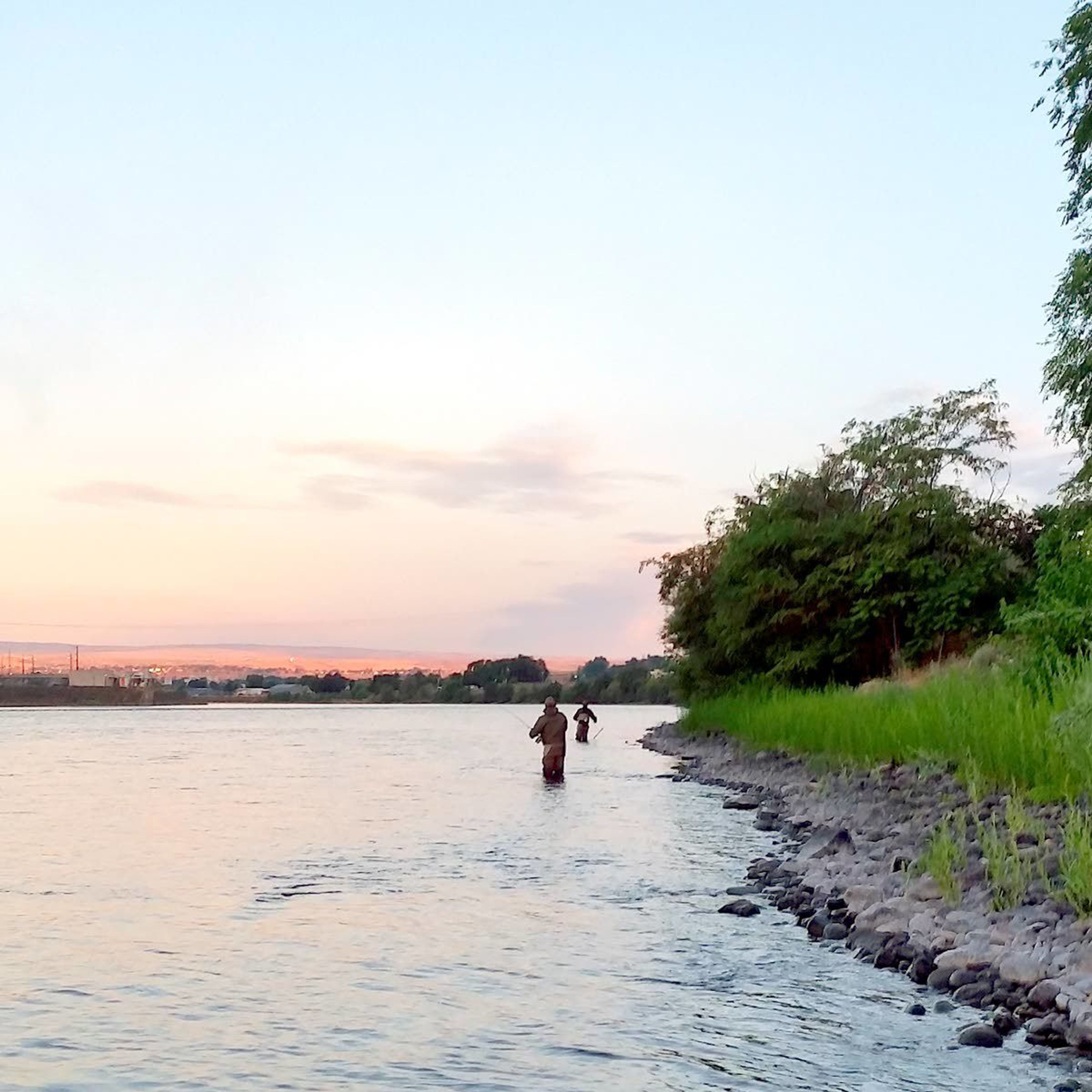
Rockwell frequently fly fishes for cutthroat trout in the South Fork and its tributaries. He said the lower end of Crooked River is as good as it gets.
"The reason it is so good is because the habitat is so good," he said. "I'm just amazed they are even considering it."
The fisheries professionals disagree with his assessment of the habitat quality there today. But they say when the project is done, anglers will be pleased.
"It's going to be amazing when we are done," Harris said. "This is going to have its short-term impacts but once we get the work done it's going to come back pretty fast."
The Forest Service is preparing an environmental impact statement on the project that is expected to include an estimated cost. The soonest work would start would be 2015. More information is available at http://www.fs.fed.us/nepa/nepa_project_exp.php?project=40648.
---
Barker may be contacted at ebarker@lmtribune.com or at (208) 848-2273. Follow him on Twitter @ezebarker.
Related

Advertisement
Daily headlines, straight to your inboxRead it online first and stay up-to-date, delivered daily at 7 AM

The Tribune