NorthwestJuly 13, 2021
Smoke impedes some efforts
Aircraft grounded in fight against Snake River Complex of fires Monday, but are able to be used against Lick Creek Fire
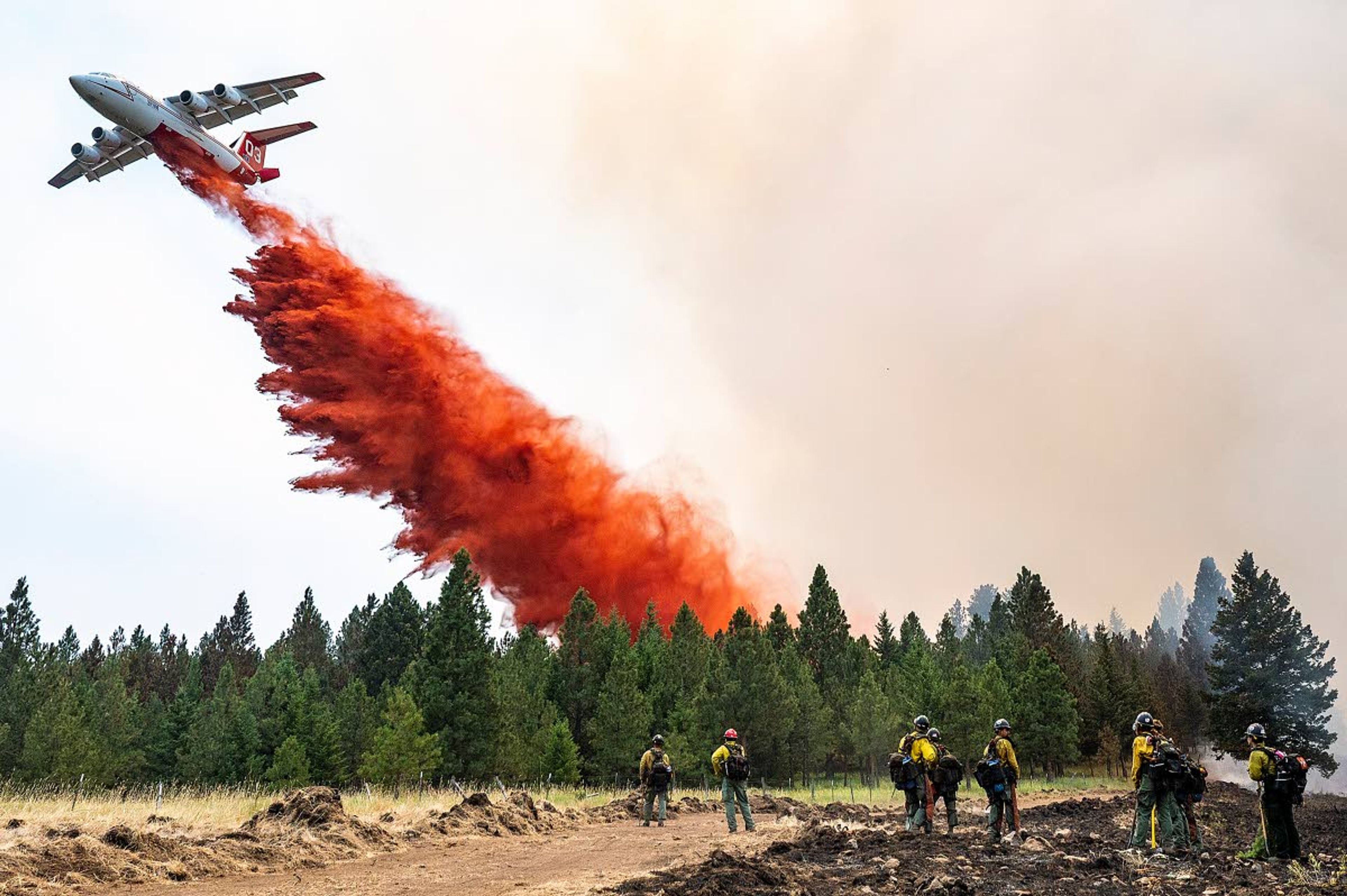
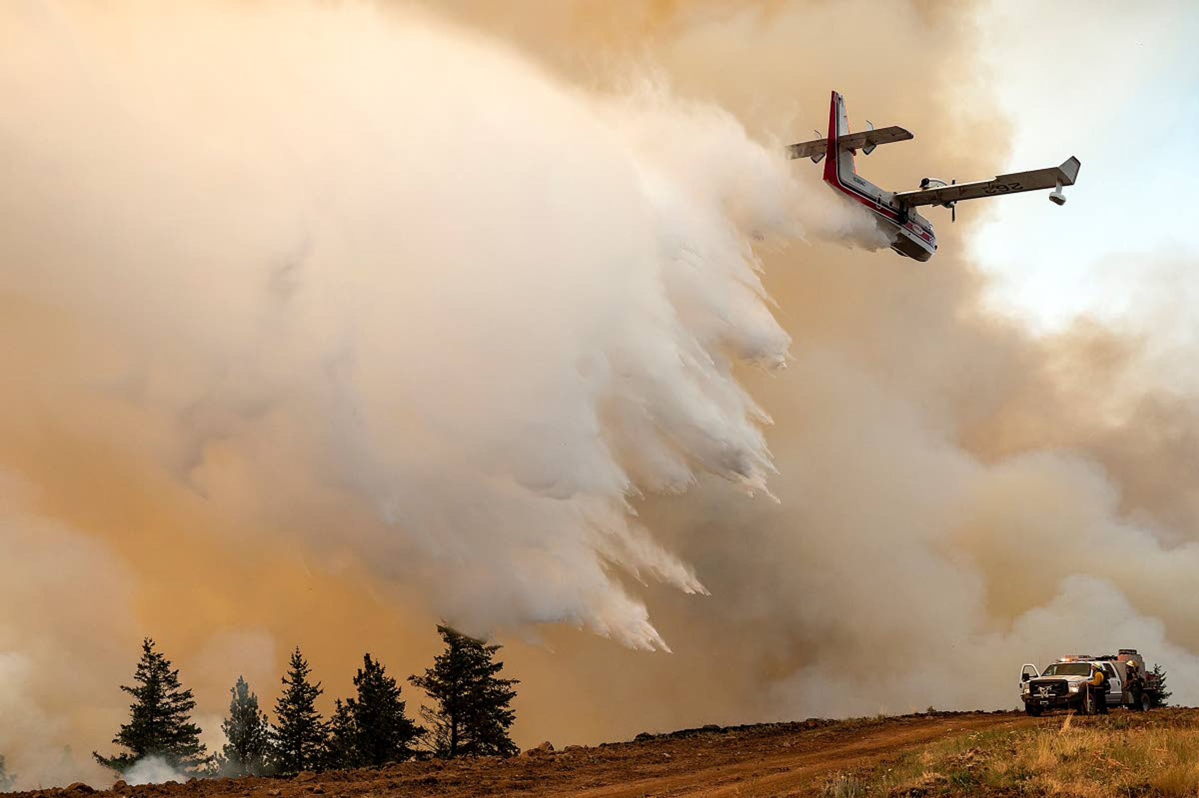
Smoky conditions grounded helicopters and planes working to suppress the Snake River Complex of fires south of Lewiston on Monday but air resources were able to fly and fight just a few dozen miles away on the Lick Creek Fire southwest of Clarkston.
Both air tankers and scoop planes worked the Lick Creek Fire Monday, which was formerly known as the Dry Gulch Fire. The 55,000-acre blaze is burning on a mix of state, federal and private land. It stretches roughly from the South Fork of Asotin Creek north to Dry Gulch and Tam Tam Ridge mostly on the Asotin Creek Wildlife Area and west into the more heavily forested Umatilla National Forest.
Fire information officials could not be reached Monday evening for an update on the blaze that started from a lightning strike Wednesday. According to a Monday morning update posted on the fire information site inciweb.nwcg.gov, firefighters had hoped to use fire to consume fuels along the Iron Springs Road to Clearwater Lookout and ahead of the northwest flank of the blaze.
Because of the dry conditions near the fire, land managers in southeastern Washington are proactively closing forests and grasslands in a move to protect both the public and firefighters.
Officials on the Umatilla National Forest closed the Pomeroy Ranger District, and the Washington Department of Fish and Wildlife closed the W.T. Wooten Unit of the Wooten Wildlife Area; the 4-O Ranch and Grouse Flats units of the Chief Joseph Wildlife Area; and the Asotin Creek and Weatherly units of the Asotin Creek Wildlife Area.
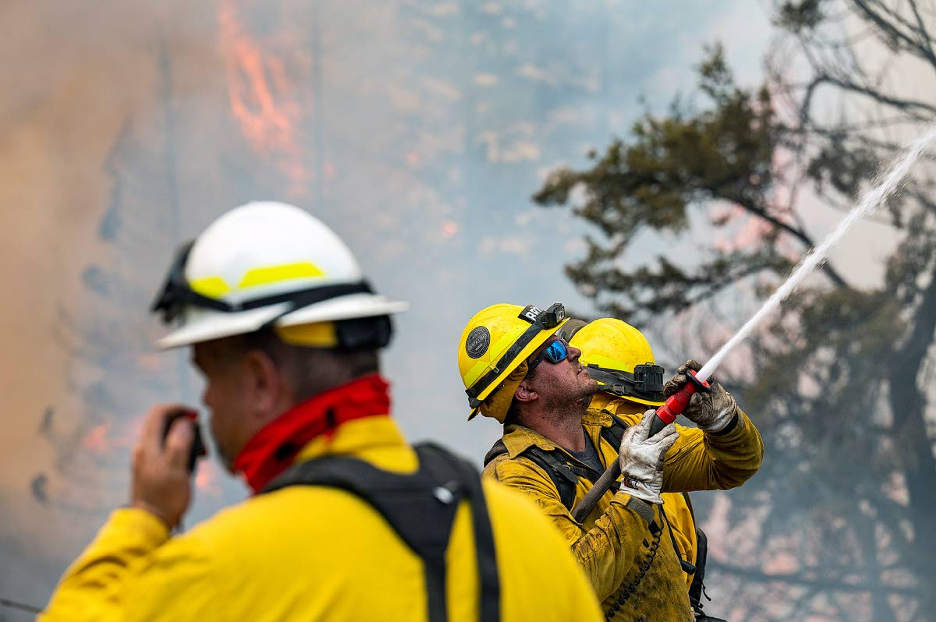
Firefighters assigned to the nearly 80,000-acre Snake River Complex just south of Waha continued to work on fire lines designed to protect the scattered community there, said fire information officer Deana Harmf.
“It was really smoky so they weren’t able to utilize aircraft, just because of the visibility,” she said.
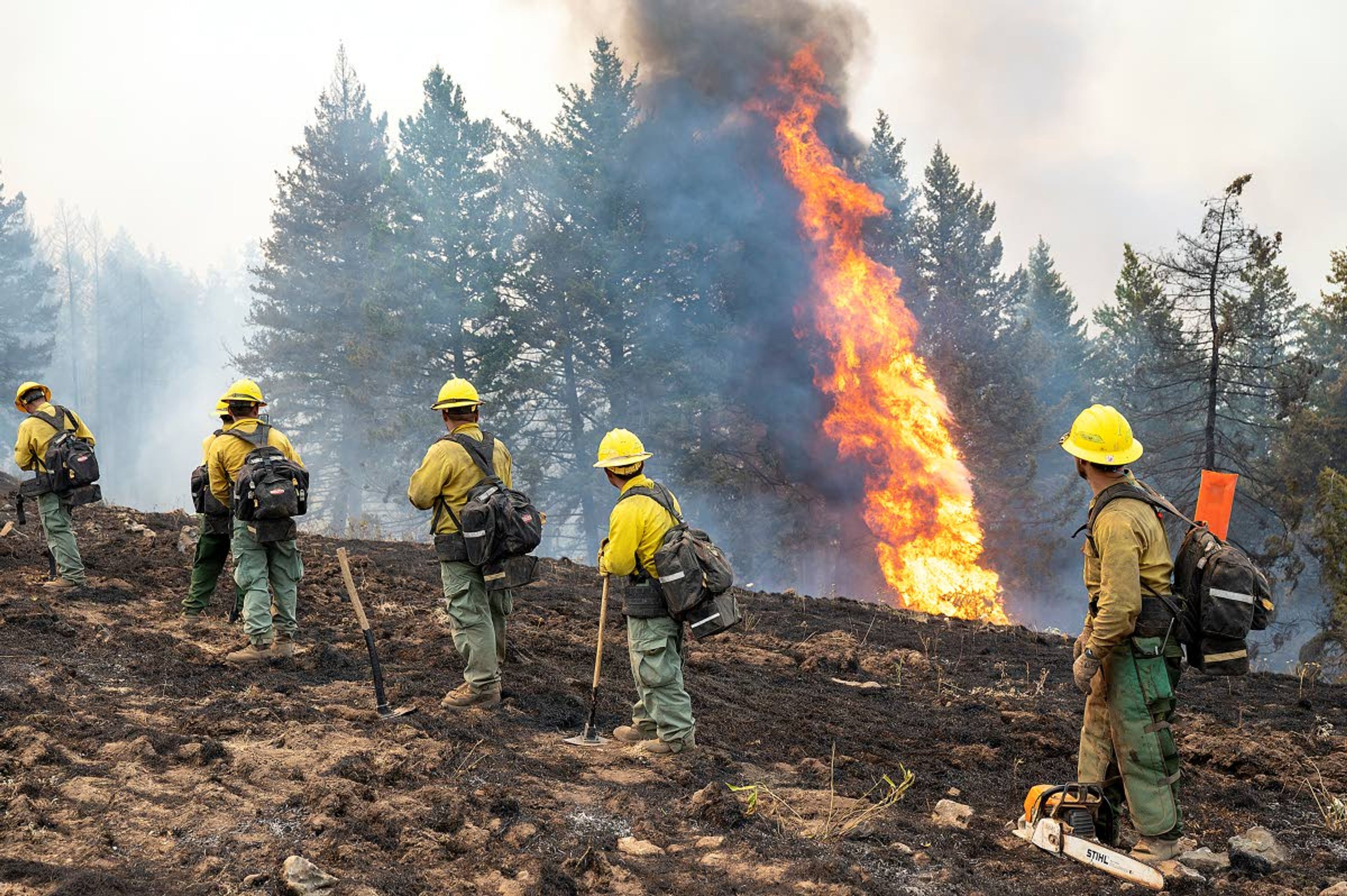
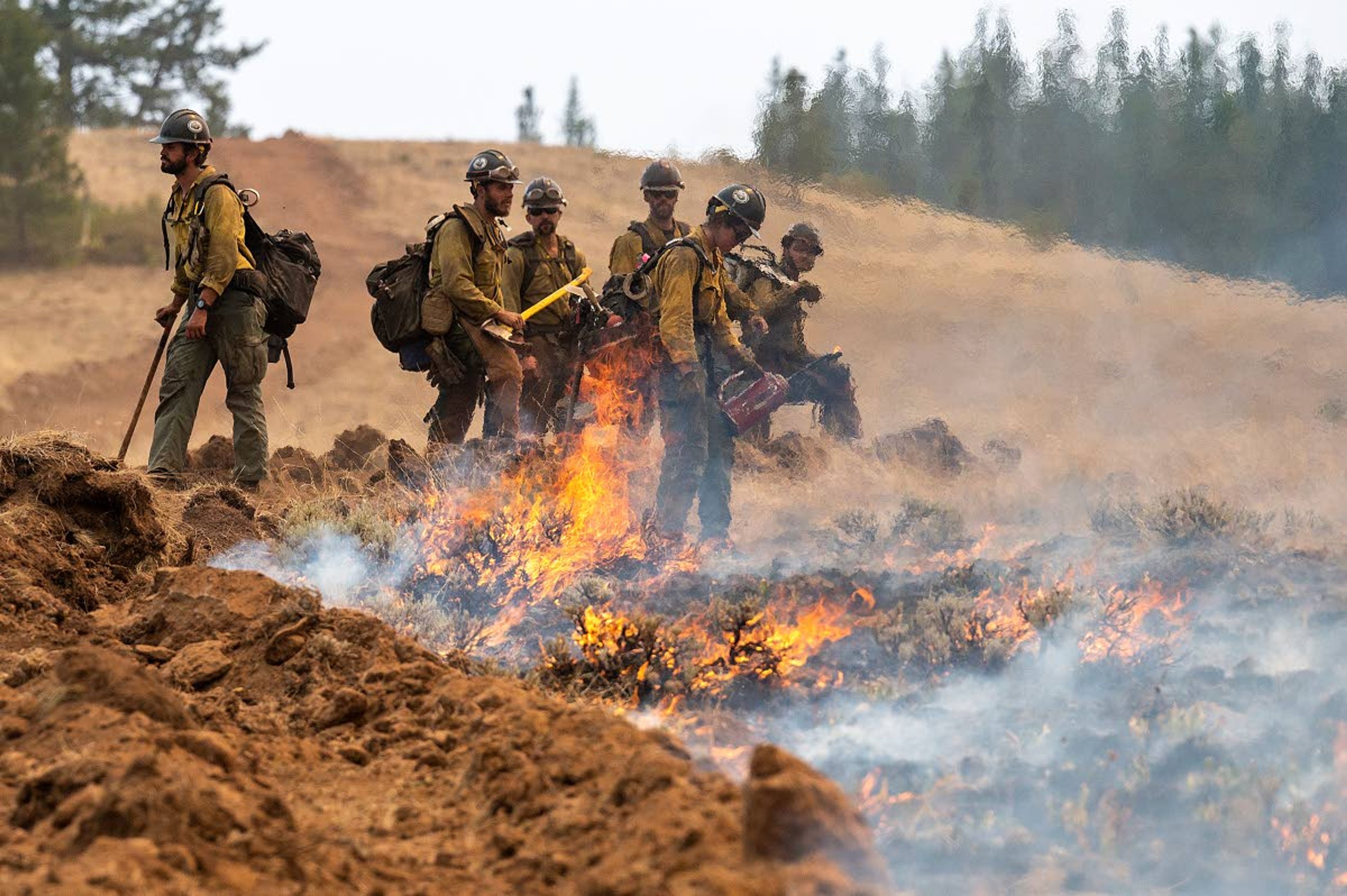
Crews are working to extend dozer lines south from the northeast flank of the fire that is burning on state land managed by the Idaho Department of Fish and Game, Idaho Department of Lands, federal ground overseen by the Bureau of Land Management, private property and land owned by the Nez Perce Tribe. The burned area that extends roughly from north end of the Craig Mountain Wildlife Management Area south of Waha almost all the way to the confluence of the Snake and Salmon rivers is made up of steep and grassy breaks and canyons along both rivers and timbered uplands on top.
Within that area, Harmf said various fronts of the fire are burning in different directions depending on terrain and weather patterns. Firefighters are trying to herd the blaze to the south by taking advantage of natural features combined with dozer lines that they are enlarging via burnout operations. The area has burned several times over the past two decades and a system of old dozer and hand lines are still on the landscape in some areas.
Where possible, firefighters are burning along both old and new lines well in front of the flames in an attempt to rob the fire of fuel when it makes runs.
“What we are trying to do is control it on our terms,” Harmf said.
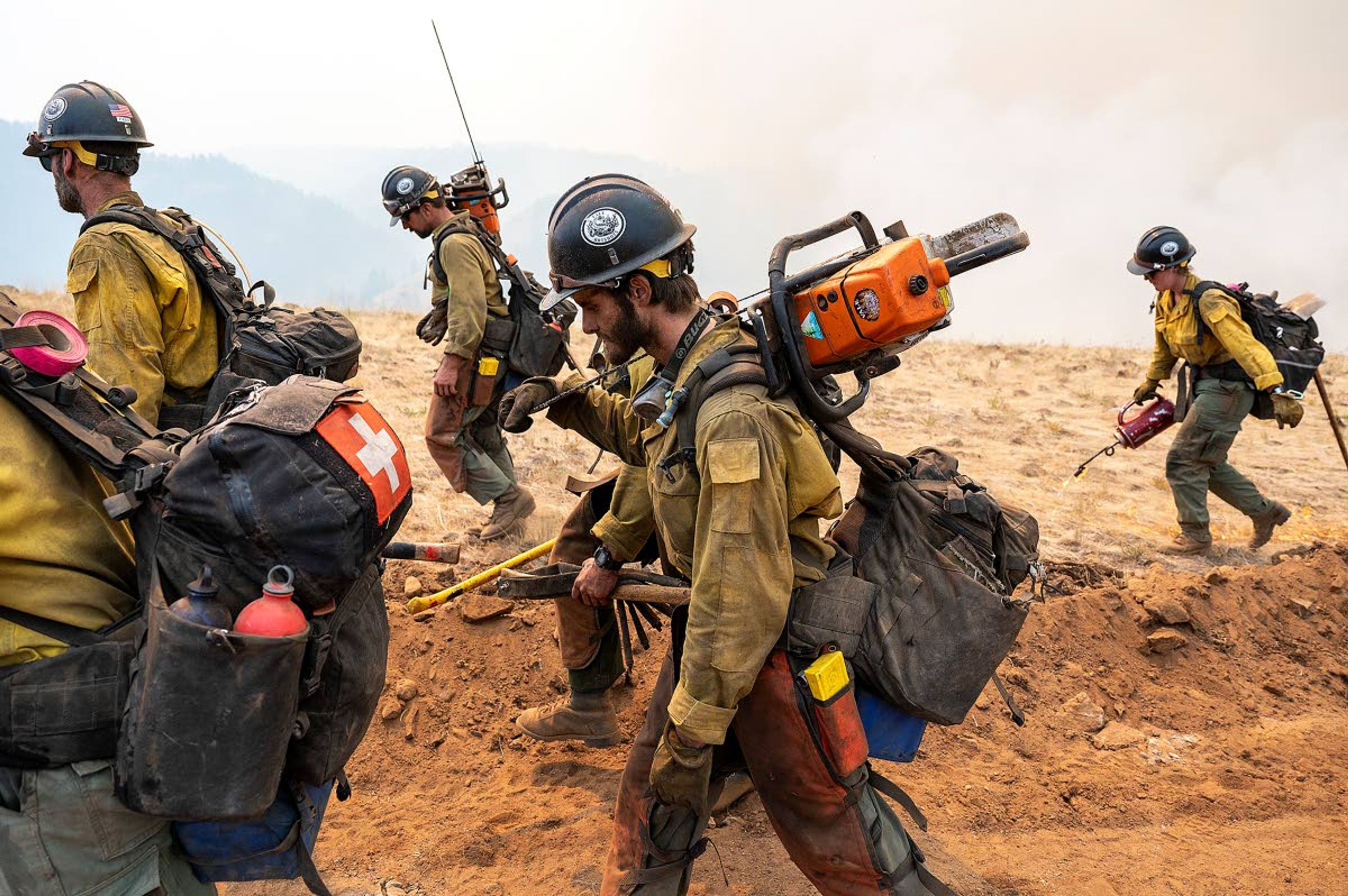
She said crews and resources continue to trickle into the fire, one of the largest in the country. The extremely hot and dry weather encompassing much of the Western United States has fueled several fires, each demanding firefighters and equipment. That has left a shortage of both as more and more fires pop up.
“That has been our biggest concern, trying to get resources for our fires,” said Kimberly Nelson, fire information officer on the Dixie Fire. “It’s going to be a tough, long season.”
Daily headlines, straight to your inboxRead it online first and stay up-to-date, delivered daily at 7 AM
She noted firefighters started reporting unusually intense fire behavior as early as the middle of June.
“This fire season is a month and a half early from what we see historically,” she said. “We are dealing with fire conditions we would typically see later in the year. That makes (forest managers) and firefighting (teams) nervous about what is to come.”
Those working to suppress the Dixie blaze continue to work on fire lines protecting the tiny and isolated community. Nelson said calm weather is giving firefighters time to work.
“The weather has presented us with an opportunity. We are not expecting heavy wind, so it’s a great opportunity to lay some fire line and secure the west flank of the fire.”
The Orofino Fire Department was able to get help Sunday evening when a blaze erupted in the Canada Hill area of the small town along the Clearwater River. The 18-acre fire started on Dewey Street, said Don Gardner, Clearwater County Emergency Coordinator, and burned up timbered slopes there, threatening dozens of homes.
A very large air tanker, also known as a VLAT, was diverted from another blaze and dropped retardant on the fire. Nearly two dozen other aircraft, seven engines and two hand crews worked to suppress the fire.
“It was amazing how fast we got support,” Gardner said.
He said the cause of the fire is under investigation but is believed to be accidental in nature. He said the fire is a good reminder how dangerous conditions are this summer.
“It’s a tinderbox,” Gardner said. “One bad mistake can cause a catastrophic fire, so we have to be on alert.”
The Too Kush 2 Fire, 2 miles east of Kooskia, grew to 1,150 acres Monday. Most of the growth was from burnout operations that are expected to continue today and extend the footprint of the fire to 1,300 acres, according to an Idaho Department of Lands news release. Firefighters hope to hold the fire at that size and have started mop-up operations on some flanks of the fire.
The Johnson Creek Fire northeast of Elk River has burned 240 acres.
Three fires burning near Lolo Pass are being managed as the Granite Pass Complex. They include the BM Hill, Lolo Creek and the Shotgun fires. The 837-acre BM Hill Fire is on the Lolo National Forest northwest U.S. Highway 12. It is expected to merge with the 60-acre Lolo Creek Fire. The 50-acre Shotgun Fire is 7 miles north of Powell. Lolo Pass Visitor Center is closed because of the fires.
The Leland Complex, which includes the Sand Mountain and Pine Creek fires burning on and near the Palouse Ranger District of the Nez Perce-Clearwater National Forest, have covered about 1,000 acres.
Barker may be contacted at ebarker@lmtribune.com or at (208) 848-2273. Follow him on Twitter @ezebarker.
Story Tags
Related


Advertisement
Daily headlines, straight to your inboxRead it online first and stay up-to-date, delivered daily at 7 AM

The Tribune